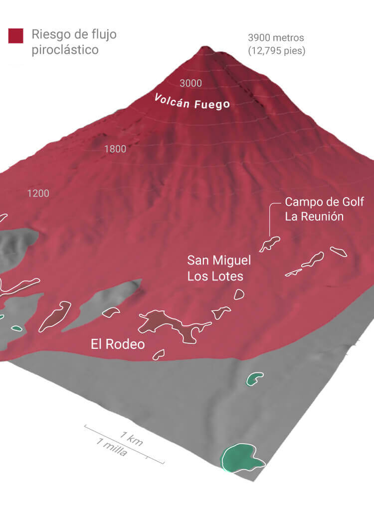
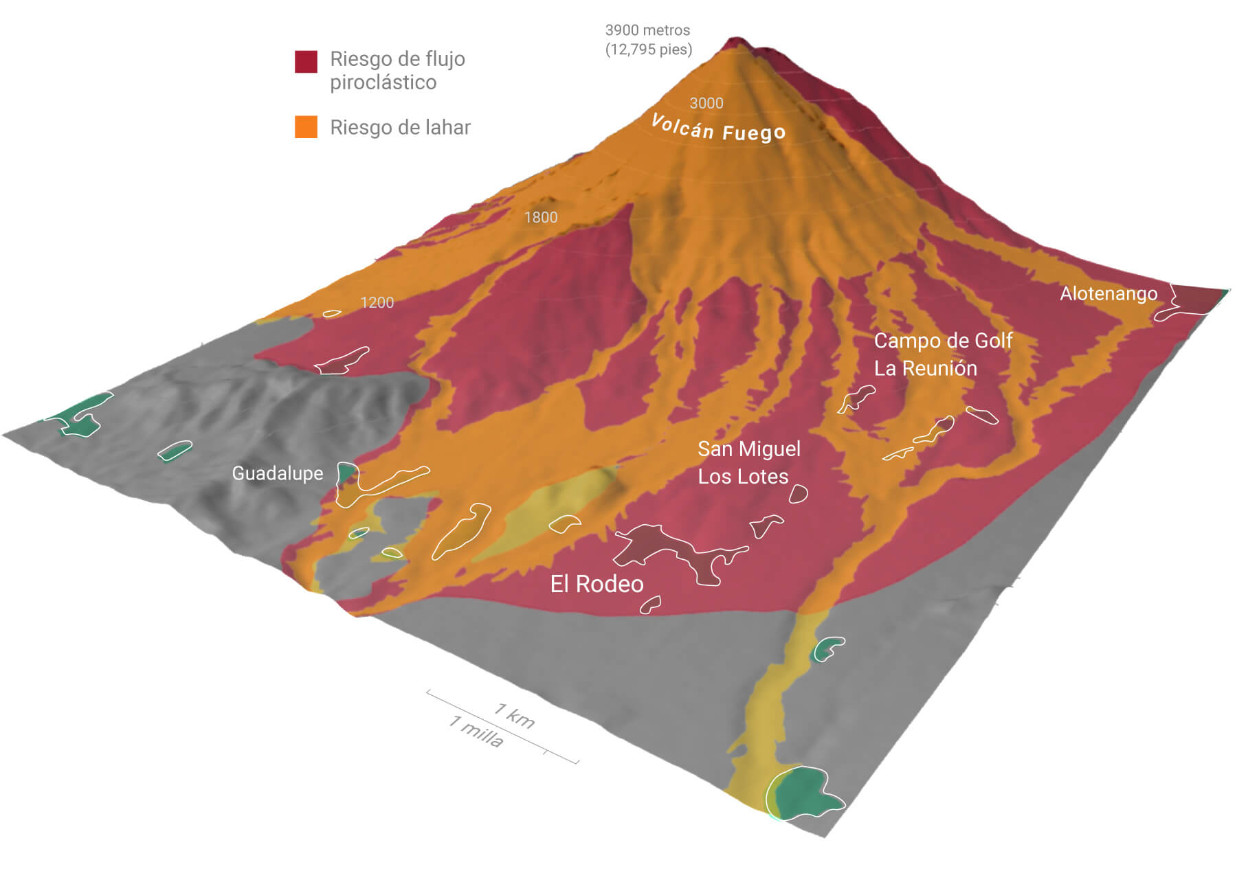
In 2001, the United States Geological Society (USGS) published a study of the hazardous zones around the Fuego volcano. They published several maps indicating how many of the surrounding communities were in danger of lahars (flows of volcanic material mixed with water) and pyroclastic flows.

According to the study, in the event of an eruption, pyroclastic flows, lava and rocks can reach the red shaded area. Many habitable towns are located here.

The same study shows, in the orange shaded areas, which zones are in danger of lahars.

As the study confirmed, the recent explosion of the Fuego volcano, generated a pyroclastic flow that destroyed the communities of San Miguel Los Lotes, La Reunion golf course and parts of El Rodeo.

Decline of the pyroclastic flow of hot gases and ash along the side of the volcano.

The main building in the residential area and La Reunion golf course were completely covered by ash.

The town of San Miguel Los Lotes was left completely covered by several meters of ash. The largest death toll and missing are from this area.

A survivor of San Miguel Los Lotes watches his surroundings covered in ash